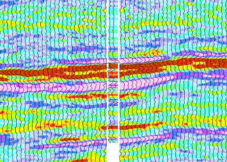
Seismic inversion software is a powerful geophysical technique used to extract valuable information about the subsurface properties of the Earth. By transforming seismic data into detailed geological models, seismic inversion plays a crucial role in various industries, such as oil and gas exploration, engineering, and environmental studies. In this article, we delve into the concept of seismic inversion, its significance, and the general workflow involved in this fascinating process.
Understanding Seismic Inversion
Seismic inversion is a computational technique that aims to convert seismic reflection data into quantitative subsurface properties, such as acoustic impedance, density, and porosity. Seismic reflection data is acquired by sending seismic waves into the ground and recording the reflections that bounce back from different geological layers. These reflections are then processed and analysed to generate seismic images of the subsurface, providing a visual representation of the Earth’s structure.
However, seismic images alone do not provide detailed quantitative information about the physical properties of the subsurface. This is where seismic inversion comes into play. By using mathematical algorithms and theoretical models, seismic inversion reconstructs the subsurface properties, giving geoscientists a more accurate and comprehensive understanding of the Earth’s composition.
The Seismic Inversion Workflow
- Data Acquisition: The first step in seismic inversion is acquiring high-quality seismic data. This involves deploying seismic sources, such as vibrators or explosives, to generate seismic waves. The reflected waves are then recorded by geophones or hydrophones placed on the surface or in boreholes.
- Pre-processing: Before conducting the inversion, the seismic data undergoes pre-processing to enhance its quality. This includes noise removal, data filtering, and corrections for various sources of distortion.
- Creating the Initial Model: An initial subsurface model is constructed based on the seismic reflection data. This model serves as the starting point for the inversion process.
- Selection of Inversion Method: There are various inversion methods available, each with its advantages and limitations. The choice of inversion method depends on the specific geological objectives and the type of data available.
- Post-stack inversion: This method works directly on the stacked seismic data to estimate rock properties at each depth level. It is relatively quick but may lack fine details.
- Pre-stack inversion: Pre-stack inversion uses angle-dependent seismic data to estimate properties at different angles of incidence. It offers more detailed information but is computationally more intensive.
- Forward Modeling: In forward modeling, synthetic seismic data is generated based on the initial model. This synthetic data is then compared with the real seismic data to assess the quality of the initial model and make adjustments as necessary.
- Iterative Inversion: The inversion process typically involves iterations, refining the subsurface model to improve accuracy with each iteration. This is done by comparing the synthetic data generated from the updated model with the real seismic data until a satisfactory match is achieved.
- Interpretation and Analysis: Once the inversion is complete, geoscientists interpret the final model to gain insights into the subsurface properties. The results can be used for reservoir characterization, hydrocarbon exploration, geotechnical analysis, and more.
Seismic inversion is a vital tool that bridges the gap between seismic data and quantitative subsurface information. By transforming seismic reflections into detailed geological models, seismic inversion enables geoscientists to understand the Earth’s composition with greater accuracy. The workflow involved in seismic inversion is a meticulous and iterative process that involves data acquisition, pre-processing, inversion methods selection, forward modelling, and interpretation. As technology continues to advance, seismic inversion will remain at the forefront of modern geophysics, unlocking the Earth’s hidden secrets and supporting various industries in their pursuit of understanding and utilizing the Earth’s resources.


